Welcome to DOMESTIC TOURISM PHILIPPINES!
This is a blogsite created by some students of University of the Philippines - Asian Institute of Tourism. From the usual class reporting, we are bringing out the students' research on Domestic Tourism. Feel free to read and make comments. Let us know how we can improve this site.

NCR (1) (2) (3) (4) | CAR (1) (2) (3) | Region I (1) | Region II (1) (2) | Region III (1) (2) (3) | Region IV-A (1) (2) (3) (4) (5) | Region IV - B (1) (2) (3) (4) (5) (6) (7) (8) | Region V (1) (2) (3) (4) | Region VI (1) (2) (3) | Region VII (1) (2) (3) (4) (5) | Region VIII | Region IX | Region X (1) | Region XI (1) | Region XII (1) | Region XIII (1) (2) | ARMM (1) (2)

Dec 10, 2014

How to get there: Zamboanga Peninsula

By Air


You can take the daily flight from Manila to Pagadian City. Pagadian City is the capital of Zamboanga del Sur.

Regular price rates 2,179 PHP Manila to Zambonga and Zamboanga to Manila (Round Trip)
Promo rates 1,878 PHP Manila to Zambonga and Zamboanga to Manila (Round Trip)


By Sea


With meals, insurance and linen 2,179 PHP in tourist class only in one way, so when planning to go there, by air is the best way.


Fun Facts about Zamboanga Peninsula

1. Zamboanga was once the biggest city in the world

Zamboanga lost its claim to the title as the world’s biggest city in area in 1948.


2. Zamboanga is the sardines capital of the Philippines. I've also heard that 70 percent of the sardines company in the Philippines are operating in Zamboanga. Everyday, 1000 tons of sardines was processed that can be sold locally and imported internationally.


3. There is a a coconut museum in Zamboanga. One of the most important branches of the Philippine Coconut Authority was in Zamboanga City.


4. The most inexpensive 18-hoe golf course membership all over the world was found in Zamboanga. We all know that golf is the most expensive sports, it was indeed a good news to those people who was golf lover like me. 


5. There are dancing chorizo-makers in the public market during the day in Zamboanga.  

Things to buy in Zamboanga Peninsula

Top Five things to buy in Zamboanga Peninsula


The first one I want to recommend to you is the famous sardinas of Zamboanga. It is called as spanish style sardines that was originally made in Zamboanga. It was ready to eat and not that "lansa" or fishy smell.


100-150php per piece


100php 3 pcs of cans


If you are a pizza lover, you must try this delicious kind of pizza
\
Solo chicken pizza for only 80 php


They also have pancit guisado. Enjoy the taste of heaven with this meals they're serving for guests. These are some of the treats you must consider in buying some pasalubong meals.


Barquillos, this can be also a yummy treat for guests like me, I have tasted this and I liked it so much! Tourists should also try this!


Lastly malongs


Dec 2, 2014

Get To Know Region 8: Eastern Visayas

The Eastern Visayas region is a diamond in the rough. Sure, you won’t find luxe hotels or glitzy party scenes around here. But you will find raw natural attractions that speak for themselves, waiting to be discovered.


The region consists of the provinces of BiliranEastern SamarLeyteNorthern SamarSamar and Southern Leyte and the cities of BaybayBoronganCalbayogCatbaloganMaasin,Ormoc and Tacloban. Tacloban City is its regional center. The local climate varies between wet and wetter — the region’s perpetually lush landscapes reveal the absence of a real dry season. 
Majority of the locals here are Waray and speak Waray-Waray.Warays are descendants of Austronesian migrants who settled in the Philippines in the Iron Age. In 1521, they became the first Filipinos encountered by Europeans, care of Portuguese explorer Ferdinand Magellan. They subsequently became one of the first local groups to convert to Christianity. Notable Warays include Former First Lady Imelda Marcos and statesman Norberto Romuáldez.
The region remains relatively under-the-radar compared to other tourist destinations in the Philippines, but this is slowly changing. More and more people troop here in pursuit of rugged coasts and landscapes, secret caves and waterfalls, and fascinating histories — as well as the company of people content with the simple life, happy to enjoy the bounty of nature.

Photo source: rappler.com


BILIRAN

Photo source: gopixpic.com

During the early Spanish era, what is now called Biliran Island was known as Isla de Panamao. The term refers to an ethnic fishing net. The present name, believed to be adopted sometime between the late 1600s and the early 1700s, was, according to many publications, derived from a native grass called borobiliran which once grew abundantly on the island’s plains. A contending theory states that the name came from the word bilir, which was defined in an old Visayan dictionary to be the “corner or edge of a boat, vase or anything protruding, like veins, or the furrow made by the plow.” 

The first town, named Biliran, was founded in 1712. During this time, the island was a part of the province of Cebu. Biliran, together with the islands of Samar and Leyte were constituted into a separate province in 1735. Later when Samar and Leyte were split into two provinces in 1768, Biliran became part of Leyte.

It is an island province in the Philippines located in the Eastern Visayas region. Biliran lies just a few kilometers north of Leyte Island. Its capital is Naval. Biliran is one of the country's smallest and newest provinces, being formerly a part (sub-province) of Leyte until achieving full-fledged province hood in 1992.


EASTERN SAMAR

Photo source: batch2006.com


It's a province of the Philippines located in the Eastern Visayas region. Eastern Samar occupies the eastern portion of the island of Samar. Bordering the province to the north is the province of Northern Samar and to the west is Samar province and to the east is the vast Pacific Ocean. Off the coast of Leyte Gulf, the province faces the province of Leyte. The province occupies a total land area of 466,047 hectares (1,151,630 acres). The province has a population of 461,300 as of 2010 census. The common language is Waray. Commercial activities in the province are centered on the provincial capital of Borongan City. Generally, the province's major economic resource is fishery and agriculture which include production of copra, corn, rice, sugar, and vegetables. Tourism potential is untapped on the northern part of the province.


Capital: Borongan

Source: scribd.com


NORTHERN SAMAR

Photo source: journeyingjames.com


Northern Samar may be reached over land via the Pan Philippine Highway, which connects the key cities of the Samar provinces. Most of the towns are situated along the northern coasts facing the San Bernardino Strait.  Another point of entry into Northern Samar is through the north-western town of Allen. It is possible to take the ferry from Matnog off Sorsogon (the southernmost province of the Bicol Region) to this town, which is connected to Catarman by the winding highway along the coast. Northern Samar is bounded on the north by the San Bernardino Stait, on the east by the Pacific Ocean, on the west by the Samar Sea, and on the south by Western Samar. Its total land area is 3,498 sq. kilometers. 

The province is composed largely of low and extremely rugged hills and small lowland areas. It also has small and discontinuous areas along the coasts and its rivers are usually accompanied by alluvial plains and valleys. The province is endowed with relatively rich and fertile soil that most crops can grow on it. It consists of 24 towns.


Capital: Catarman

Source: tourism.gov.ph


WESTERN SAMAR


Western Samar, formerly Samar, is a province of the Philippines located in the Eastern Visayas Region. It is 802 kilometers from Manila and occupies the westernmost section of the Samar Island. It is bounded on the north by the province of Northern Samar, on the east by Eastern Samar, on the west by Samar Sea and on the south by Leyte Gulf.
Prior to the coming of the Spaniards in 1596, many names were given to Samar Island such as Samal, Ibabao and Tandaya. The name Samar was derived from the local dialect “samad” which means wound or cut. This term appropriately describes the rough physical features of the island that is rugged and directly cut apart by streams. 


Relative to its location, Western Samar serves as a reference point for tropical cyclone occurrences as it is within the typhoon belt of the country. But this does not mean that it is frequently hit by tropical cyclone. Rainfall is evenly distributed throughout the year and the province has no distinct dry and wet season. 

Western Samar has its share of nature’s beautiful spots. Among its jewels which attracts tourists and local folks include unexplored mountains and caves with exotic wildlife, unspoiled shores with coral reefs, beautiful beaches and waterfalls. The major industries in Western Samar are agriculture, cattle raising, fishery, forestry, mining and tourism. Hematite and magnetite chromate, nickel and manganese are the major ores which can be found in the province. It is the main supplier of fishes in the country due to its relatively long coastline in the western side extending over 300 kilometers. 

Capital: Catbalogan


LEYTE

Photo source: tinikling.tripod.com


Leyte is one of the bigger islands of the  country. The island counts only two  cities of moderate size. Tacloban, situated in the northeast, is the provincial capital of the island and far out the biggest city of Leyte. Ormoc City in the western part of the island, is smaller and a more typical region town with the mixture of feature of modern and traditional services. 

The island measures about 180 kilometres (110 mi) north-south and about 65 kilometres (40 mi) at its widest point. In the north it nearly joins the island of Samar, separated by the San Juanico Strait, which becomes as narrow as 2 km (1.2 mi) in some places. The island province of Biliran is also to the north of Leyte and is joined to Leyte island by a bridge across the narrow Biliran Strait. To the south Leyte is separated from Mindanao by the Surigao Strait. To the east, Leyte is somewhat "set back" from the Philippine Sea of the Pacific Ocean, Samar to the northeast and Dinagat Islands to the southeast forming the Leyte Gulf. To the west is the Camotes Sea.


SOUTHERN LEYTE

Photo source: globalpinoy.com


Southern Leyte is a province of the Philippines located in the Eastern Visayas region. Maasin City is the capital of the province. Southern Leyte was once a sub-province of Leyte before it was divided from the latter. Southern Leyte includes Limasawa, an island to the south where the first Christian Mass was held and considered to be the birthplace of Christianity in the Philippines. The province ranks as the second least populated in the region. According to the 2010 census, the province has a population of 399,137.


Southern Leyte's geological features created several issues in the province after the flooding of the Subangdaku River and the 2006 mudslide in Guinsaugon. Organizations warned the province it was susceptible to natural occurrences like landslides and floods. Southern Leyte contributes to the economy of the country. It forms an important part of the inter-island transportation system of the country, with ferries transporting people and goods between Liloan and Surigao del Norte in Mindanao. The province is well known for its quality abaca products and is the country's major producer of abaca fiber.


Nov 30, 2014

What you prolly don't know about the Southern Bicol Region

And for my last blog post, tidbits of trivia that your probably don't know about the Southern Bicol Region. Well, you may probably know, but still, wouldn't it be fun to compile all the cheesy trivia? :)

Did you know that...

About 49 eruptions have been documented since its first blast in 1616. Worst eruption occurred was on February 1, 1814 wherein about 12,000 people evacuated in Cagsawa and sought refuge inside the church but lost their lives as the town was flooded with lava and also destroyed the church. Hence, the church tower was the only thing that remains and become a tourist spot and known as the Cagsawa Ruins. (Source: philippinetouristattractions.com)

Image Source: wowlegazpi.com

Nov 25, 2014

Getting to Know Caraga

Caraga Region was created through Republic Act 7901 which was approved on February 25, 1995 by then President Fidel V. Ramos. Caraga is the newest region of the Philippines, also designated as Region XIII. designated as Region XIII, the region is situated in the northeast section of Mindanao. It is bounded on the North by the Surigao Strait, on the West by the Provinces of Bukidnon and Misamis Oriental, on the South by the Province of Davao del Norte and on the East by the Pacific Ocean.
Read more...

Things You Didn't Know About the Caraga Region

  • Did you know that the tallest tree in the Pilippines is found in Caraga? Yes, this tree which was recognized on December 7, 1980, is a Giant To-og which has a towering height of 65 meters, a diameter of 360 centimeters, and is over 200 years old. The tree is located along the Butuan - Barobo Highway in Barangay Alegria, San Francisco, Agusan del Sur.
Read more...

Nov 23, 2014

Nov 16, 2014

The Fact List: Things You Didn't Know About ARMM

We were taught history ever since we were in grade school.
Admit it; you were bored out of your mind (unless you were addicted to history, anyway).
What if I told you that we can make it fun through blogging?
Find out things you didn't know about ARMM in The Fact List!

Things you dont know, Things i dont know :) Region 6 with Lui :))

The things that you dont know in Aklan


1.Motag living Museum is the number 1 ranked attraction in Aklan

They say we cannot bring back the past, well not for MOTAG LIVING MUSEUM
The Motag Living Museum is an interactive museum where one can experience rural life before machinery was introduced.

http://media-cdn.tripadvisor.com/media/photo-s/06/62/12/06/motag-living-museum.jpg
ploughing the field before sowing

You'll never know how fun this coud be unless you try :) get messy and have fun!!


http://i.vimeocdn.com/video/478590951_640.jpg
native folk dance
 
You will heard folk songs that are not even written in history books, you will welcome in a house built without using nails,and get serve with native delicacies.


2. Hike through a mangrove forest in  Bakhawan Eco-Park,
where you’ll find mangrove forests intact.


Bakhawan Eco park


The Katunggan It Ibajay Eco-Park, look for the centuries-old mangroves, the biggest of which is 20 meters tall and eight meters in circumference.


http://farm6.static.flickr.com/5524/12324695504_c01d9019c6.jpg


Did you know that???
Guimaras Island is located between the islands of Panay and Negros in the Western Visayas region.


3. Did you know the second oldest Lighthouse?


Its an 18th century Spanish lighthouse and the second oldest in the country.


https://c2.staticflickr.com/8/7241/7204159012_15eabb6959_z.jpg
Guisi Lighthouse


Before you will reach the lighthouse to the top you still need to make a fifteen minute trek up the hill.
Climb carefully because its rusty and have spiral staircase.


top view of Guisi Lighthouse
 
You’ll get a beautiful, sweeping view of the Guimaras strait.


4. Did you know a house that built on top of a rock??


Roca Encantada


Roca Encantada means ‘Enchanted Rock’. The resthouse was built in 1910
According to an article, the exterior façade of the house resembles a palatial manor, but in reality, the space inside the house isn’t any bigger than the average two or three-bedroom condominium.


https://blogger.googleusercontent.com/img/b/R29vZ2xl/AVvXsEh_wfQ5j3SbFPzskndgngZ5jZ3SEpd8O6HXp1KREoNkOXDvWyyvbMT2lk1aTw5eqEy2Dj2T1Netcb6pYf3pZOSgduBthQDN9kMflkn1z3hnJe8EFfJLj7nvlnla7qX3OGXdcSHRNEyCDpck/s1600/n8-1415.jpg

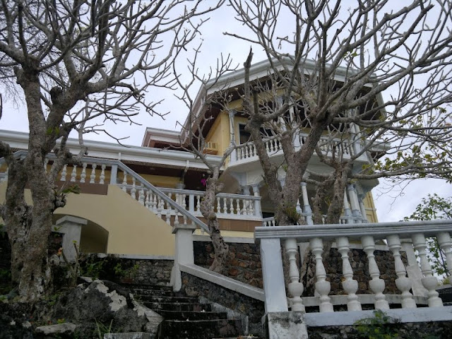
However, the house still deserves a tour of its own as it’s a heritage house as declared by the National Heritage Institute.


What you didnt know about Antique??


5. Bugtong Bato


Did you know that the town of Tuno are the seven waterfalls of Bugtong Bato, a hidden attraction behind steep ravines and large boulder formations.The name ‘Bugtong Bato’ refers to a huge rock found a few meters away from the first of the seven falls. It usually goes unnoticed due to a tree that grew on top of it.


First cascade of Bugtong-bato Falls
 
The first of these multi-tiered waterfalls is not very tall but packs a powerful cascade of water that creates a pool that’s about knee to waist-deep.


Trail to second cascade
 
After the stairs, one must climb a rope to reach the second waterfall’s side and then rappel going down. This routine will be the same for the remaining five waterfalls.


Second and third cascade of Bugtong-bato Falls


climb to the third cascade


As it is truly one of a kind, the locals ensure that Bugtong Bato is preserved and protected from destructive practices like illegal logging.


referencese

                                   http://aklan.gov.ph/


                                  http://itsmorefuninthephilippines.com/aklan/


                                  http://itsmorefuninthephilippines.com/antique/


                                  http://itsmorefuninthephilippines.com/guimaras/

Fun Facts About Rizal and Quezon Province


Want to find out what you do not know about Rizal and Quezon Province?
Top 10 Natural Attractions in Zamboanga Peninsula

Merloquet Falls Merloquet Falls

DID YOU KNOW THAT? ✯✯✯

Learning new things is fun especially if these are the facts about a certain topic that are not well-known. Here are the quick facts about Northern Bicol that you will ought to know: read more...

www.media.photobucket.com

Ready to be amazed?


Do you know where to find the smallest monkey on Earth?


Do you know who were the first settlers in Bohol?


Do you know what mountain draws the boundary between Negros Oriental and Negros Occidental?


Click here and be amazed!

Nov 15, 2014

Did You Know? (Trivial Facts About Central Luzon)


So you think you know it all? Think again! There are still a lot of things you are yet to discover in the Central Luzon Region! In this article, you would be able to uncover some interesting facts and trivia about the provinces of Bataan, Bulacan, Pampanga and Zambales that you probably haven’t heard or known before. So sit back, relax and START READING!